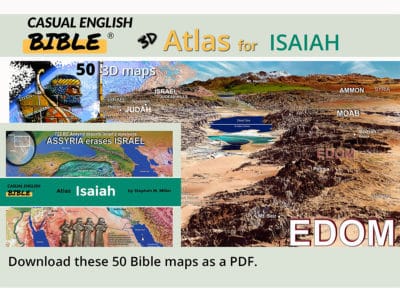
YESTERDAY I FINISHED CREATING 50 BIBLE MAPS FOR ISAIAH.
And I wrapped up my first pass at the paraphrase of Isaiah. All 66 chapters. Some beautiful. Some disgusting.
I don’t mean to seem disrespectful toward the prophet or the Bible, but how else to describe the book’s last verse:
The LORD says,
“People will go to the trash heap
To look at corpses of those who rebelled.
Forever, the worms will eat the dead.
Forever, the fire will burn.”
Isaiah 66:24, Casual English Bible
That’s one of many hard prophecies in this book. Isaiah delivers a lot of bad news. Some good. But he told his people that life would get worse before it gets better.
Maps as a change of pace
Making the maps is a huge change of pace from paraphrasing Isaiah into easy-reading English.
I’m not sure which is harder. They’re tough for different reasons and in different ways.
The maps are time-consuming and often frustrating because I’m not a cartographer. I had to teach myself some incredibly geeky software. And I had to figure out how to collect and use scientific elevation data from international space agencies in the US, Japan, and Europe.
I’ve been a word guy, not a scientific data guy.
The science of making bumps
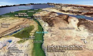
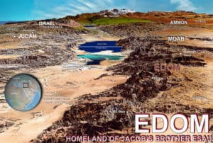
Essentially, I used the data and the software to create bumps for hills and valleys. Then I placed uniquely blended and stylized satellite photos on top. By “uniquely,” I mean if you see these maps anywhere else, they’ve either been licensed or pirated. They are distinctly Casual English Bible maps.
Some maps don’t work. I can’t pull them off. I’ve spent days trying to get the mix looking good and easy on the eyes. But sometimes I can’t find the right altitude or angle or blending of images over the elevation model. It looks ugly. Or cheesy. Or whatever. It just doesn’t look right.
Part of the problem is the resolution of the international data. If I wanted to make maps of places in the US, I could show you your favorite rock in Rock City. International data at that resolution comes at a price point that works for oil companies, governments, and people with yachts. I have a fishing pole.
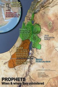
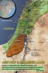
Fortunately, that’s not a problem when I’m trying to illustrate large areas like the Jordan River Valley or the Judean Hills. See what you think.
You can breeze through the Isaiah maps by going to the book of Isaiah and flipping through the chapters.
But in the meantime, I’ll let you sample a few here.
Maps for Isaiah

Freebie
If you’d like a free PDF download of the Isaiah maps, be one of the first five to SEND ME AN EMAIL with the word ISAIAH in the subject line.
I’ll send you a coupon for a free download.
Peace to you.
Casual English Bible
Steve’s Bible-background YouTube Channel
More feature articles
Bible Gateway
Leave a Reply