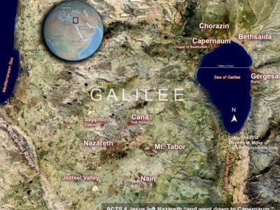
WORKING MY WAY through map-making for the Casual English Bible Gospel of Luke, I thought I’d do something odd.
I took a Landsat image from NASA and I set it on top of NASA’s newest release of elevation data. Then I created a combo map that shows detail from Galilee today, such as highways and cities, alongside the locations from Jesus’ day.
I’ve created lots of maps, but none like this one. It’s kinda fun to see the ancient sites in their context today.
I just posted this map with Luke 4 in the Casual English Bible. Once I’ve worked my way through creating maps for the rest of Luke, I’ll post high-resolution versions of the maps for download as a PDF. I’ll bundle it with the Casual English Bible Leader’s Guide and Atlas for Luke, and make it available for a dollar download.
Luke 4 also features a second, 3-D map of Galilee, which helps readers visualize the terrain.
I’m hoping these will help small-group Bible studies as they chat about the stories they read in the Bible.


Leave a Reply