I STRUGGLE making Bible maps that show much detail at low elevations.
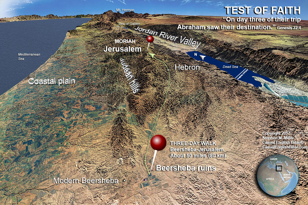
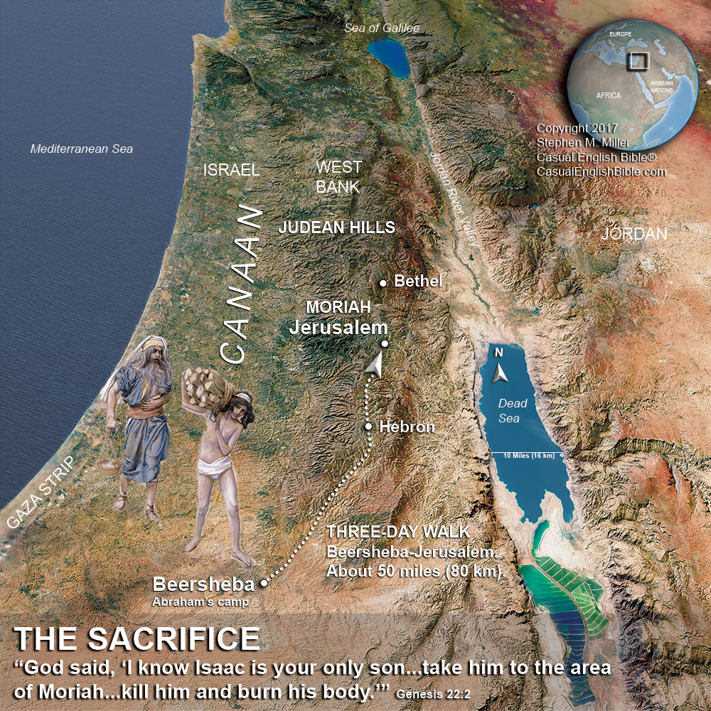
I’ve just spent several tough days making two maps of Abraham’s trip to Jerusalem. It’s the time he nearly sacrificed his son Isaac.
I deleted many other attempts, probably two dozen maps.
My problem is that NASA’s elevation data isn’t nearly as detailed for other countries as it is for the United States. The data is available, but not released. Go figure. So I do the best I can with the data I have. Yet it’s always frustrating when I’m trying to show you some low-to-the-ground views.
Weigh in
Below are a couple of maps I’ve added to Genesis 22 in the Casual English Bible. These are both scenes at a relatively low altitude. But they’re not as good as I’d like them to be.
I have two questions.
- Should I skip these low-altitude attempts and stick with higher altitude maps than look less clunky?
- If you think I should keep making these low-altitude maps, which of the two maps shown here do you find most helpful as you think about the story of Abraham and Isaac walking some 50 miles (80 km) on their three-day trip from Beersheba to what was probably Jerusalem?
Map 1
Map 2
I thank you, and my mother thanks you.
Oh, that reminds me. I’ll be releasing a new video soon. It’s an attempt to answer to the question of why men in Bible times married multiple wives and concubines.
Mom reminded me of the video not because she married into a harem, but because I often mention in her my videos. I end them by asking people who like the video to please give it a thumbs up because “my mother counts them.”
Peace to you.


I kind of like the 3D maps, Steve. Though I guess it depends on the story you’re trying to tell.
The 2D map, for instance, gives us a much better idea where things happened.
But the 3D map shows us the journey and the physical obstacles that had to be crossed. Which, in this case, may actually be more relevant to the story.
My two cents anyway.
Yeah, that’s my thought about the 3D. It can give a better sense of the landscape.
I think Map 2 looks great. I’d definitely use that one!
Thanks, David. I spent more time on Map 1, trying to make it work better. I wanted to give a sense of the hills Abe and Isaac had to maneuver. But I think I’ll need better elevation data to be able to do that well. Or I could draw pictures like many others have done. Sadly, I can draw pictures well.
Map 2
Hey there, Dawn. Looks like map 2 is winning the vote so far. Hope all is well in your corner of the world.
For now, I am studying the life of Joshua in depth and it is fun for me to have a map, like map 1 of the Jordan River Valley. Map 1 shows it like you are on the ground looking at the terrain. Map 2 is like you are looking from an airplane. Personally, I can’t wait to get started all over again studying the life of Abraham and then I will want BOTH maps, so I am really no help at all, as I love all the hard work you do!!!! Thank you so much!
Thanks Kathy. Good to know the maps help.
Map 2
My vote is for map 2. I don’t live in the area so a ground view is no help but the high in the sky view makes since to me and I can go OK I see now.
God bless you and your family and thanks for the hard work.
Map 2….I like the visual, it tells a story. They both look great…nice job.
Hi Steve! I think both maps have benefits, but I think Map 1 conveys the terrain to be crossed on the
journey. My two cents.